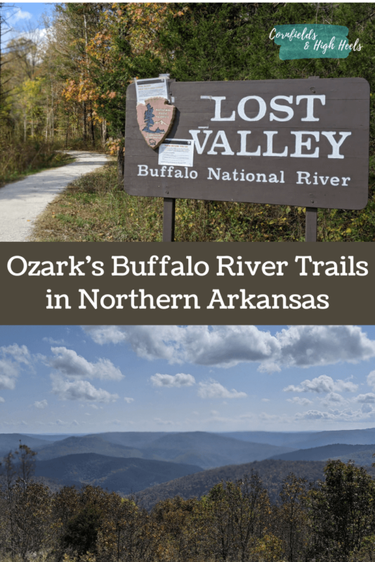
Ozark Buffalo River Trails in Northern Arkansas
Disclaimer: Blog posts may contain affiliate links/ads or be sponsored/hosted. If you click on these links, I may earn a small commission. This helps keep the blog running and supports me – at no cost to you. If you have any questions, please read my disclaimer and privacy policy. All opinions on Cornfields & High Heels are my own.
Updated January 2025
Get ready for some gorgeous views of northern Arkansas and the Ozark Buffalo National River trails! Arkansas has some surprisingly beautiful trails. I’ll admit that I had no idea what to expect when we planned a trip to southern Missouri and the northern Arkansas area. I hadn’t seen many articles about hiking in the Ozark Mountains from my regular travel reads, so I didn’t know what to anticipate. But the views blew me away upon arrival, and now I want to visit again!

The Ozark Mountains
The Ozark Mountains, also known as the “Ozarks” for short, are heavily forested highlands between the Appalachians and the Rockies. An area in northern Arkansas is also home to the Ozark National Forest, where the highest point exceeds 2,000 feet. The Ozarks are underground springs and streams that empty into one of four rivers. We spent our day hiking along the Buffalo National River.
Our day trip to northern Arkansas
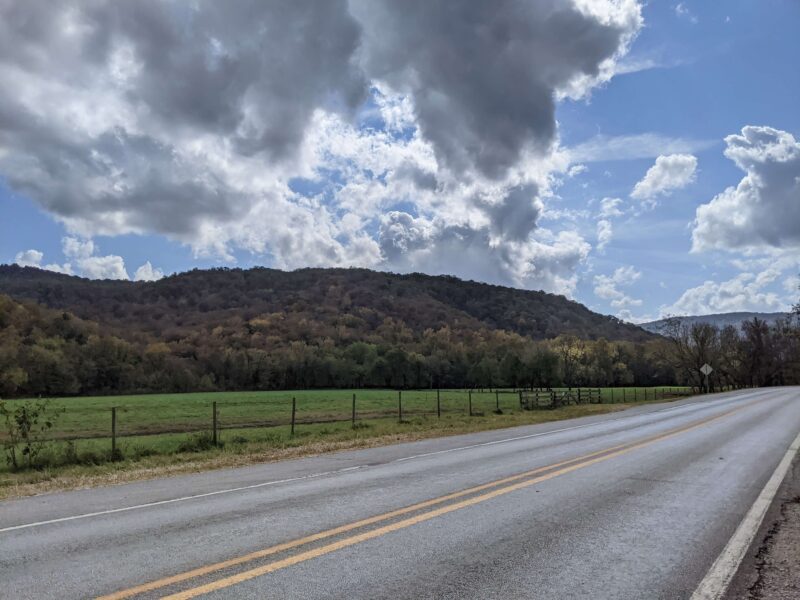
Our trip started in Branson, Missouri. Getting to the Arkansas Ozarks from Branson is easy until you get off the interstate, which was most of our driving. When going to the Ozarks, you are in some pretty remote areas of Arkansas. If you get car sick quickly, I suggest taking some Dramamine before you go! Go with a real map (Atlas) and plan because cell phone service will be non-existent or spotty. We didn’t make a plan for which trail we’d be hiking; however, I did have a list of them mapped out. Our main goals were to find great mountain views, see elk, and walk at least one trail.
We drove Highway 43 from Harrison, Arkansas, to Ponca, Arkansas, and made our final stop for hiking in Ponca. It was the closest town to civilization in the area (for our route), and you can spot elk here too!
Buffalo River Outfitters
There is so much to do in this region! Camping, hiking, mountain biking, kayaking, and canoeing are all popular activities in the Ozarks. Buffalo Outfitters Center (aka “BOC”) signs are everywhere in the mountains. BOC is authorized to provide canoe and transportation services to the National Buffalo River. They also offer service for most cabin rentals, camping, shuffle services for the trails, and float trips in the area.
After arriving in Ponca, we were relieved to find civilization (and a bathroom) at the Buffalo Outdoor Center. We stopped here for a quick rest, a connection to their free wifi, and a bathroom break. This is the only WiFi and indoor bathroom available for miles (keep this tip in mind!). While there, you can book a rental, ask questions about the trails, and pick up snacks or equipment (I bought a new mug!).
Be wary of the free-roaming chickens and roosters here. Ha! We returned to our vehicle in the parking lot only to find a cluster of chickens and roosters (I don’t know the difference!) had taken residence under our SUV and refused to leave.
Historic Ponca General Store
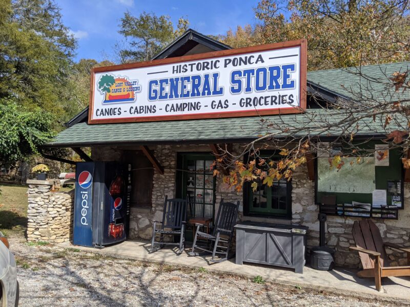
There is also an old-fashioned general store in Ponca, so we stopped by to grab a few natural sodas. They have lots of supplies, some groceries, stickers, and merchandise; however, note that they do NOT have a bathroom available to the public (not even for paying customers). It’s a cool little shop, but because the Buffalo Outdoor Center store has wifi and bathrooms just 1/2 a mile down the road, we also opted to go there.
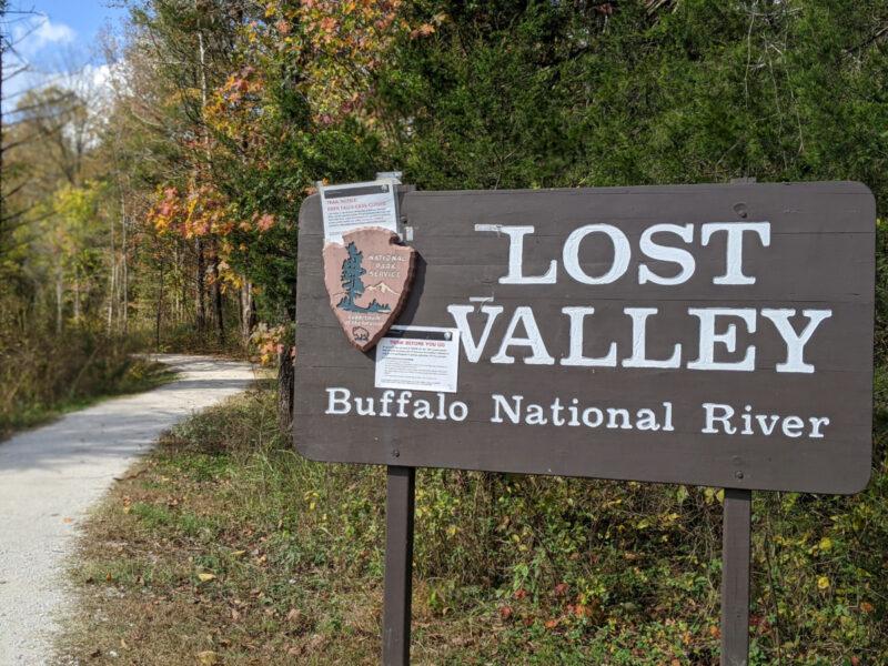
Lost Valley Trail on the Buffalo National River


We decided on the Lost Valley Trail for our hiking adventure, the most popular trail in the National Ozark Forest! It’s located just down the road from the Buffalo Outdoor Center and across the street from an elk viewing area.
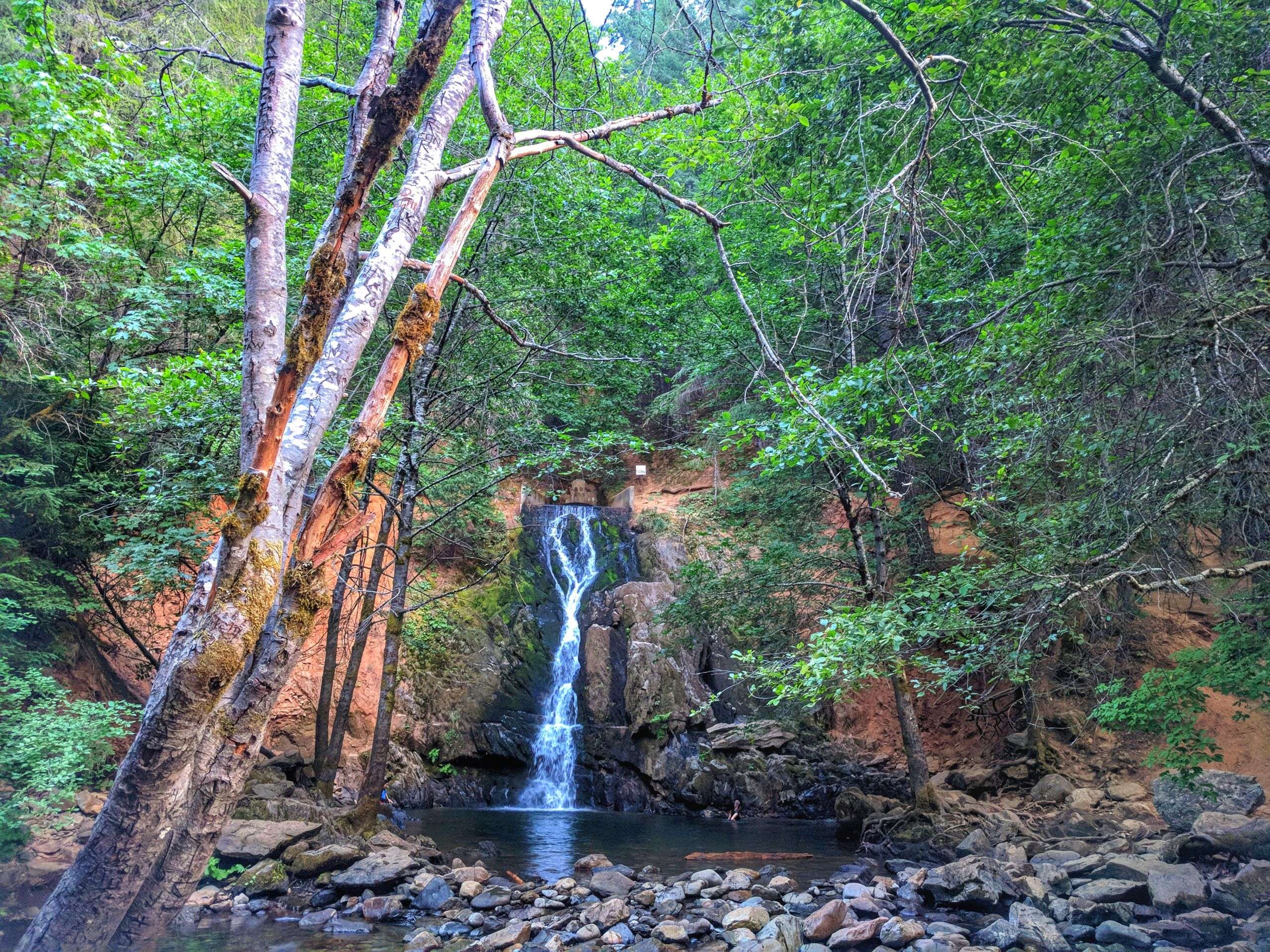
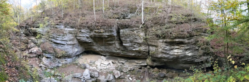
Eden Falls and Cobb Cave can be found on this trail! However, in the Fall, you can’t see the waterfall; during a pandemic, the cave might be closed (check before arriving to see if the cave will be open). The best viewing times are in the Spring; check the water levels here to see if the waterfall will be visible when you visit. The waterfall was not flowing when we hiked at the end of October.
A canyon forms Lost Valley, and you’ll find springs, underground waterways, and natural rock formations along the trail. Wildflowers and plants could be seen (and smelled) even in the Fall. Watch out for bats, especially when visiting the cave! We spotted bats outside the cave, resting under the rocks’ edges even during the day.
This trail is great for all ages. It does require steep climbing of natural rock stairs to get to Cobb Cave and Eden Falls, so keep this in mind if you have physical limitations. The first portion of the trail is wheelchair accessible, and benches are placed every 1/2 mile for rest. Plan 2+ hours to complete this hike if you stop to see the cave and waterfall. Cobb Cave can be found at the end of the 2.2-mile trail, and Eden Falls is nearby.
Note: Please wear orange while on trails during hunting seasons.
The BOC Ponca Downhill MTB Trail
The BOC Pona Downhill MTB (mountain bike) Trail offers a fantastic view of the Ozark Mountains. You can easily access this trail off Fire Tower Road; a sign identifies the trail and points to a gravel parking lot. When we visited, they appeared to be building some cabin or BOC building at the entrance.
This mountain bike trail is not for beginners. It’s an advanced trail, and we only stopped by for a beautiful view from the trailhead. You can pay to take a shuttle (7 days a week) from the Buffalo Outdoor Center to the top of the trail. It’s a free trail open to the public, so riding is at your own risk.
Elk Viewing
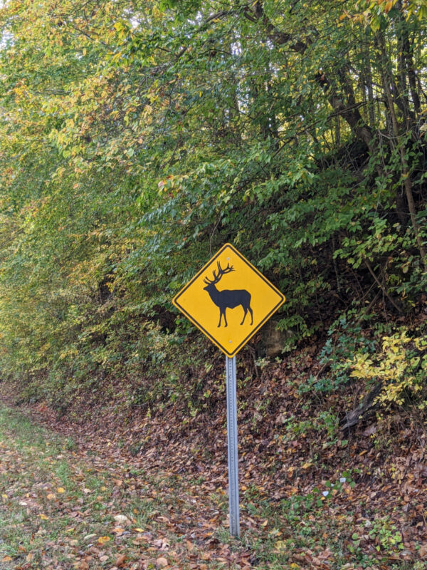
You can spot elk if you are patient and visit at the right time! Spotting elk is possible year-round; however, Fall is the best time since that is their mating season. They are best spotted along the Buffalo National River between Ponca and Boxley after sunrise and late afternoon. Although we waited patiently for over an hour at sunset, along with many others parked for a view – we didn’t get a chance to see any. If you stop, please do not block the highway or approach/feed the elk.
You can stop by the Elk Education Center (across the street from the Buffalo Outdoor Center) for a free exhibit on why there are so many elk in this area.
Tips for hiking along the Buffalo National River
- Wear sturdy hiking boots that lace up to your ankles.
- Pack a hiking bag with sunscreen, bug spray, water, and snacks.
- Plan and tell someone where you will be hiking. Cell phone service is extremely limited in the parks.
- Stay on the trails! This is very important and worth repeating.
- Do not leave trash along the trails; carry your trash out.
- Leave wildlife alone; do not approach or disturb.
My favorite hiking gear and accessories can be found here.
Wear to stay in Northern Arkansas
Although remote, there are plenty of places to stay in the Ozark Mountains and Ponca area. Cabins, vacation rentals, and small inns can be found scattered throughout the region. Check VRBO for vacation rentals and cabins.
Check out our YouTube video on the National Buffalo River Trails! Don’t forget to subscribe!
Pin it for later!